 |
||
CLOUDLAND JOURNAL - NOVEMBER 2025 (click for previous months) |
|

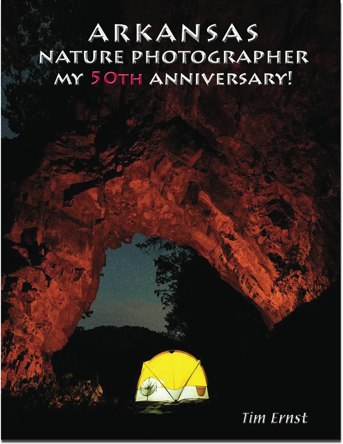
11/25/25 - my BRAND NEW picture book is NOW AVAILABLE. CLICK HERE to order autograhed copies. And coming soon to a bookstore near you. (I have them available at the gallery too)
SLIDE PROGRAMS ARE BACK! Scroll down to see the full schedule... (or CLICK HERE)
Our Canvas Gallery IS OPEN BLACK FRIDAY AFTERNOON, November 28th, NOON-5; and also by appointment other days. CLICK HERE for more info
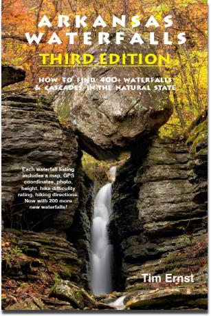
You can now order a signed copy of our new ARKANSAS WATERFALLS guidbook #3 direct from me! CLICK HERE for details. (you can also pickup at our gallery and save shiping cost)

ARKANSAS GREATEST HITS picture book has been re-released and autographed copies now available here.
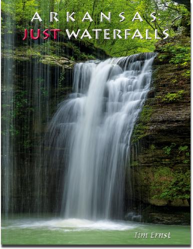
ARKANSAS: JUST WATERFALLS is a new coffee table picture book - autographed copies available here.
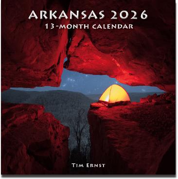
2026 13-Month Wall Calenar - CLICK HERE to order
2025 slide program schedule
December 3 (Wednesday), book sales begin at 5pm, show starts at 5:30pm, Fayetteville Public Library
December 4 (Thursday), book sales begin at 5:30, show starts at 6pm, Fort Smith Library
December 5 (Friday), book sales begin at 5:30, show starts at 6pm, Springfield Nature Center (Missouri)
December 9 (Tuesday), book sales begin at 5:30, show starts at 6pm, Bentonville Library
December 13 (Saturday), show starts at 10am, Mountain Home Library
December 14 (Sunday), book sales begin at 12:30, show starts at 1pm, Stephens Arkansas Nature Center, Little Rock
December 18 (Thursday), book sales begin at 6:30, show starts at 7pm, Doc Bryan Lecture Hall, Arkansas Tech University, Russellville
2026 dates:
January 6 (Tuesday), book sales begin at 5:30, show starts at 6pm, Garland County Library, Hot Springs
January 8 (Thursday), book sales begin at 9:30, show starts at 10am, Hot Springs Village
Januuary 16 (Friday), noon-ish, Ouachita Center, UA Rich Mountain, Mena